Washington Map

Request Free Visitor Guides

Thomas Lake Trail - No. 111

Contact Info
Gifford Pinchot National Forest
2455 Hwy. 141
Trout Lake, WA 98650

Phone:
509-395-3400
Basics
Length:
3.3 miles (5.3 km)
Difficulty:
Difficult
Elevation Range:
4000 feet to 4500 feet
Elevation Change:
500 feet
Usage:
Extra Heavy
Season:
Mid-July to October

Description

This heavily used trail passes numerous lakes prior to its connection with the Pacific Crest Trail. It begins along Road 65 and climbs gently as it passes through a dense forest, coming to Dee, Thomas, and Heather Lakes at approximately 0.6 mile. The trail climbs to a meadow, then continues past Brader Lake and Naha Lake to Rock Lake and Little Rock Lake. It then turns south and passes Lake Umtux. As the trail continues through the broad plateau meadow, it passes numerous unnamed ponds and tiny lakes. The trail descends into the timber, passing Lake Sahalee Tyee, and ends at Blue Lake with the junction of the Pacific Crest Trail.

Lake Sahalee Tyee lies in the shallow crater of an old volcano. This is an area where Native Americans built slow-burning fires in trenches, preserving berries for later use by drying them over the radiant heat.

Dee Lake, Thomas Lake, Heather Lake, Eunice Lake, Brader Lake, Lake Naha, Rock Lake, Lake Umtux, Lake Sahalee Tyee, and many scenic meadows.

Details

Length:
3.3 miles (5.3 km)
Difficulty:
Difficult
Elevation Range:
4000 feet to 4500
Elevation Change:
500
Usage:
Extra Heavy
Season:
Mid-July to October

Map + Directions

Basic Directions

Road 65 (The trail is not accessible from the north via Road 30 because the Rush Creek Bridge is out.)


Copyright © 1997 - 2024 The Go Travel Sites. All Rights Reserved and.

Email Page Link

Complete the form below to email this page to a friend or family member's email. You can send yourself an email as well. Your email and your recipient's email will NOT be shared with anyone. See our full Privacy Policy for details.
:
:
:


:
Copy Yourself on the Email Yes No
:
:

1

Select one or more Free Visitor Guides below

2

Complete the form to receive your guides by mail

Below are the Free Visitor Guides for Seattle. More Visitor Guides are available in Washington. Click here to view them all!

Visit Anchorage Visit Anchorage Visit Anchorage
AlaskaThe Best of Alaska Anchorage is the gateway to Alaska adventure.
Request this Free Visitor GuideRequested! You're all set! Request a few more Visitor Guides, or complete the form below to receive your guides by mail.
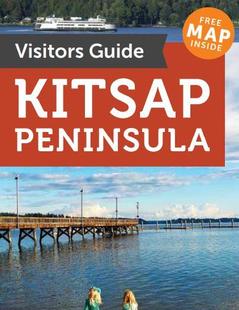
Kitsap Peninsula Kitsap Peninsula Kitsap Peninsula
Puget SoundThe Kitsap Peninsula is for those who are drawn to the sea. Located in the heart of Puget Sound, the Peninsula is surrounded by over 300 miles of shoreline and is situated between the dramatic mountain Olympic and Cascade mountains ranges of Washington.
Request this Free Visitor GuideRequested! You're all set! Request a few more Visitor Guides, or complete the form below to receive your guides by mail.
Olympic Peninsula Olympic Peninsula Olympic Peninsula
Northwestern WashingtonIf over 60 miles of pristine wilderness coastline sounds appealing to you, the Olympic Peninsula is the place to be. Several untouched beaches provide scenery which makes a perfect setting for a romantic stroll or a reflective solitary walk along the shore.
Request this Free Visitor GuideRequested! You're all set! Request a few more Visitor Guides, or complete the form below to receive your guides by mail.