Washington Map

Request Free Visitor Guides

North Fork Umatilla Trail - No. 3083

Contact Info
Umatilla National Forest
1415 West Rose
Walla Walla, WA 99863

Phone:
509-522-6290
Basics
Length:
9.8 miles
Difficulty:
Easy
Time:
6 - 7 hours
Trailhead Elevation:
2350 feet
Elevation Range:
2350 feet to 5000 feet
Elevation Change:
2650 feet
Usage:
Heavy
Season:
March to October

Description

Since horses are not allowed in the Umatilla Forks day use area, where the lower trailhead is located, horse users are required to use the Lick Creek trailhead to access the North Fork Trail. From the lower trailhead, the trail follows the North Fork of the Umatilla River. The lower trail gains 450’ in the first 4 miles. This is the easiest part of the trail and is popular with anglers, backpackers, day hikers and horseback riders. The upper and more difficult portion of the trail climbs 2000’ in 5.8 miles along a south-facing slope with sparse timber. This section of trail offers the least amount of encounters with other recreationalists, as well as an unobstructed view of the North Fork of the Umatilla drainage. Potable water and vault toilets are available at the lower trailhead. We encourage all horse traffic to access this by using the Lick Creek trailhead and then cutting over on a spur trail to the North Fork trail.

A Northwest Forest Pass is needed to park at this Trailhead. This trail is open to foot and horse traffic only sine it is located within the North Fork Umatilla Wilderness.

Details

Length:
9.8 miles
Difficulty:
Easy
Time:
6 - 7 hours
Trailhead Elevation:
2350
Elevation Range:
2350 feet to 5000
Elevation Change:
2650
Usage:
Heavy
Season:
March to October
Useful Map(s):
USGS: Bingham Springs, Andes Prairie

Map + Directions

Basic Directions

1) Lower Trailhead: Located 33 miles east of Pendleton on Umatilla River Road, approximately 11 miles east of Gibbon. You will continue past the Bar-M Ranch and the Corporation Guard station to the Umatilla Forks day use area. The trailhead is located at the end of the cul-de-sac.

2) Upper Trailhead: From State Highway 204, ½ mile west of the Tollgate Store, turn south onto Forest Service Road #3719. Follow this road to the 040 Road then turn right. The upper trailhead is located at the end of the 041 Road on Coyote Ridge near English Springs.


Copyright © 1997 - 2024 The Go Travel Sites. All Rights Reserved and.

Email Page Link

Complete the form below to email this page to a friend or family member's email. You can send yourself an email as well. Your email and your recipient's email will NOT be shared with anyone. See our full Privacy Policy for details.
:
:
:


:
Copy Yourself on the Email Yes No
:
:

1

Select one or more Free Visitor Guides below

2

Complete the form to receive your guides by mail
Visit Anchorage Visit Anchorage Visit Anchorage
AlaskaThe Best of Alaska Anchorage is the gateway to Alaska adventure.
Request this Free Visitor GuideRequested! You're all set! Request a few more Visitor Guides, or complete the form below to receive your guides by mail.
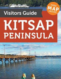
Kitsap Peninsula Kitsap Peninsula Kitsap Peninsula
Puget SoundThe Kitsap Peninsula is for those who are drawn to the sea. Located in the heart of Puget Sound, the Peninsula is surrounded by over 300 miles of shoreline and is situated between the dramatic mountain Olympic and Cascade mountains ranges of Washington.
Request this Free Visitor GuideRequested! You're all set! Request a few more Visitor Guides, or complete the form below to receive your guides by mail.
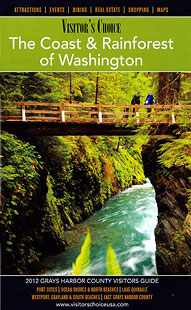
Grays Harbor Grays Harbor Grays Harbor
WesternSpend time for part of the day relaxing near the inspiring Pacific Ocean, then, if the mood strikes you, you could find yourself in a lush rain forest one hour later. Although water is a big part of Grays Harbor, there are still beautiful land-based places to visit and enjoy.
Request this Free Visitor GuideRequested! You're all set! Request a few more Visitor Guides, or complete the form below to receive your guides by mail.
Oregon's Mt Hood Territory Oregon's Mt Hood Territory Oregon's Mt Hood Territory
Northern OregonFrom majestic Mount Hood to the green and sprawling Willamette Valley, Oregon's Mount Hood Territory is a place to be explored. Enjoy conquering historic hiking trails or take on Mount Hood on skis for an experience not soon to be forgotten.
Request this Free Visitor GuideRequested! You're all set! Request a few more Visitor Guides, or complete the form below to receive your guides by mail.
Olympic Peninsula Olympic Peninsula Olympic Peninsula
Northwestern WashingtonIf over 60 miles of pristine wilderness coastline sounds appealing to you, the Olympic Peninsula is the place to be. Several untouched beaches provide scenery which makes a perfect setting for a romantic stroll or a reflective solitary walk along the shore.
Request this Free Visitor GuideRequested! You're all set! Request a few more Visitor Guides, or complete the form below to receive your guides by mail.
Bellingham Whatcom County Bellingham Whatcom County Bellingham Whatcom County
Canadian BorderWe offer a break from the ordinary. With magnificent natural scenery, skiing and snowboarding at Mt. Baker, hiking, arts and theatre, charming villages and water adventures like whale watching – Bellingham Whatcom County is a unique area of Washington state. Visit our website to plan your trip.
Request this Free Visitor GuideRequested! You're all set! Request a few more Visitor Guides, or complete the form below to receive your guides by mail.