Washington Map

Request Free Visitor Guides

Council Bluff Lake

Contact Info
401 Fairgrounds Road
Rolla, MO 65401

Phone:
573-364-4621
Phone 2:
573-341-7453
Basics
Season:
May to October
Fees:
Day use fee: $3 per standard vehicle; $12 per bus.

Description

This 440 acre lake is the largest of the lakes in the Mark Twain National Forest. The recreation area serves anglers, campers, picnickers, hikers, bicyclists, and swimmers. Drinking water and vault toilets are conveniently located..

Details

Season:
May to October
Fees:
Day use fee: $3 per standard vehicle; $12 per bus.
Camping Info
Wild Boar Campground has 39 single sites, 7 double sites, 9 walk-in sites, and 4 group sites. Nightly fees for single sites are $8; double sites are $16; group sites are $25.
Additional Details:

Highlights

This 440 acre lake is the largest of the lakes in the Mark Twain National Forest. The recreation area serves anglers, campers, picnickers, hikers, bicyclists, and swimmers.


Swimming/Picnicking

Chapel Hill Beach/Picnic area has a concession stand, changing rooms, flush toilets, water fountains, showers, and a 54,000 sq. ft. sand beach. A small play area is located adjacent to the beach. Canoes and paddle boats are available for rent.


Fishing and Boat Launch

Council Bluff Lake is stocked with large mouth bass, redear sunfish, bluegill, crappie and catfish. Fishing is permitted year round. There are 2 boat launches on Council Bluff Lake: Wild Boar Hollow and Enough. Fishing regulations are established by the Missouri Department of Conservation.


Trail

A 12-mile loop provides hiking and mountain biking opportunities along the lake shore. 2 trails permit campers to access Lake Shore Trail from the campground. Trace Creek section of the Ozark Trail is located just west of the recreation area.


Hunting/Gathering

Waterfowl hunting is permitted on Council Bluff Lake, and the Enough Fields provide upland game opportunities. Gathering is permitted in the entire area.


Safety: During temperate months, be prepared for biting insects, poison ivy and high temperatures. Be advised of hunting seasons. Avoid using the trail during excessively wet periods.

Amenities

Map + Directions

Basic Directions

From Potosi MO, go south 13 miles on Hwy P. Turn right on Hwy C, go 1/4 mile; turn left on Hwy DD. It is about 7 miles to the entrance. Turn at the sign and follow the paved access road.


From Steelville; Hwy 19 south to Hwy 49 at Cheeryville, turn left on Hwy 32 at Bixby, left to County Hwy 16, left to Enough Boat Launch


Copyright © 1997 - 2024 The Go Travel Sites. All Rights Reserved and.

Email Page Link

Complete the form below to email this page to a friend or family member's email. You can send yourself an email as well. Your email and your recipient's email will NOT be shared with anyone. See our full Privacy Policy for details.
:
:
:


:
Copy Yourself on the Email Yes No
:
:

1

Select one or more Free Visitor Guides below

2

Complete the form to receive your guides by mail
Visit Anchorage Visit Anchorage Visit Anchorage
AlaskaThe Best of Alaska Anchorage is the gateway to Alaska adventure.
Request this Free Visitor GuideRequested! You're all set! Request a few more Visitor Guides, or complete the form below to receive your guides by mail.
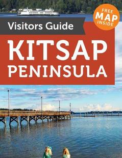
Kitsap Peninsula Kitsap Peninsula Kitsap Peninsula
Puget SoundThe Kitsap Peninsula is for those who are drawn to the sea. Located in the heart of Puget Sound, the Peninsula is surrounded by over 300 miles of shoreline and is situated between the dramatic mountain Olympic and Cascade mountains ranges of Washington.
Request this Free Visitor GuideRequested! You're all set! Request a few more Visitor Guides, or complete the form below to receive your guides by mail.
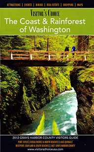
Grays Harbor Grays Harbor Grays Harbor
WesternSpend time for part of the day relaxing near the inspiring Pacific Ocean, then, if the mood strikes you, you could find yourself in a lush rain forest one hour later. Although water is a big part of Grays Harbor, there are still beautiful land-based places to visit and enjoy.
Request this Free Visitor GuideRequested! You're all set! Request a few more Visitor Guides, or complete the form below to receive your guides by mail.
Oregon's Mt Hood Territory Oregon's Mt Hood Territory Oregon's Mt Hood Territory
Northern OregonFrom majestic Mount Hood to the green and sprawling Willamette Valley, Oregon's Mount Hood Territory is a place to be explored. Enjoy conquering historic hiking trails or take on Mount Hood on skis for an experience not soon to be forgotten.
Request this Free Visitor GuideRequested! You're all set! Request a few more Visitor Guides, or complete the form below to receive your guides by mail.
Olympic Peninsula Olympic Peninsula Olympic Peninsula
Northwestern WashingtonIf over 60 miles of pristine wilderness coastline sounds appealing to you, the Olympic Peninsula is the place to be. Several untouched beaches provide scenery which makes a perfect setting for a romantic stroll or a reflective solitary walk along the shore.
Request this Free Visitor GuideRequested! You're all set! Request a few more Visitor Guides, or complete the form below to receive your guides by mail.
Bellingham Whatcom County Bellingham Whatcom County Bellingham Whatcom County
Canadian BorderWe offer a break from the ordinary. With magnificent natural scenery, skiing and snowboarding at Mt. Baker, hiking, arts and theatre, charming villages and water adventures like whale watching – Bellingham Whatcom County is a unique area of Washington state. Visit our website to plan your trip.
Request this Free Visitor GuideRequested! You're all set! Request a few more Visitor Guides, or complete the form below to receive your guides by mail.